
March 27
Boys Golf
Lenape at Moorestown, Moorestown Field Club
Shawnee at Cherry Hill West, The Links Golf Club
Girls Golf
Moorestown Tournament, 3, Moorestown Field Club
Shawnee at Cherry Hill West, The Links Golf Club
March 28
Boys Golf
Eastern at Seneca, 3:30, Little Mill Country Club
Girls Golf
Moorestown Tournament, Moorestown Field Club
Shawnee at Montgomery, 3:15, Cherry Valley Country Club
March 29
Boys Golf
Shawnee at Lenape, Ramblewood Country Club
Girls Golf
Lenape at Shawnee, Medford Lakes Country Club
Seneca at Paul VI, 3, Pennsauken Country Club
March 30
Boys Golf
Gloucester County Tech at Cherokee, Indian Spring Country Club
Paul VI at Seneca, TBD, Little Mill Country Club
Shawnee at Kingsway, 4, RiverWinds Golf Club
Girls Golf
Shawnee at Kingsway, RiverWinds Golf Club
March 31
Boys Golf
Paul VI at Shawnee, Medford Lakes Country Club
April 3
Baseball
Shawnee at Cherokee
Softball
Cherry Hill West at Cherokee
Boys Tennis
Cherokee at Bishop Eustace
Shawnee at Cherry Hill West
Boys Golf
Cherokee at Rancocas Valley, Rancocas Golf Club
Girls Golf
WWP South at Lenape, 3:30, Ramblewood Country Club
Shawnee at Eastern, Valleybrook Country Club
April 4
Baseball
Cherokee at CCTS-Sicklerville
Shawnee at Moorestown
Softball
Cherokee at Shawnee
Boys Lacrosse
West Deptford at Cherokee, 6
Eastern at Shawnee
Boys Golf
Camden Catholic at Cherokee, Indian Spring Country Club
Gloucester County Tech at Shawnee, Medford Lakes Country Club
Girls Golf
Lawrenceville School at Cherokee, The Links Golf Club, 4
Southern Regional at Shawnee, 4:15, Medford Lakes Country Club
April 5
Baseball
Vineland at Shawnee, 4
Girls Lacrosse
Rancocas Valley at Shawnee
Boys Tennis
Cherry Hill East at Shawnee
Boys Golf
Cherry Hill West at Seneca, 3:30, Little Mill Country Club
Bishop Eustace at Shawnee, Medford Lakes Country Club
Boys Track
Cherokee at Eastern
April 6
Baseball
Eastern at…


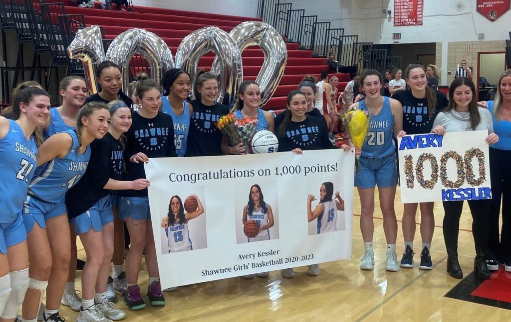

 Shawnee’s Avery Kessler (right, file photo) has scored 340 points for the 21-4 Renegades this season. (DAVID BORRELLI – THE CENTRAL RECORD)